The Great Lakes basin is one of the most bestowed with respect to water availability. However, only 1 percent of the available freshwater is renewed annually. Population growth, limited water supply and climate change also have increased stress over the available freshwater resources in the basin, which can significantly impact humans and environmental sustainability. Therefore, analyzing the distribution of water resources and water security in the basin can play a pivotal role in efficient management of available freshwater resources.
In estimating water availability, researchers generally overlook environmental water needs and overestimate the available water for human consumptive use. This can further stress freshwater resources.
Therefore, it is necessary to allocate a certain amount of available freshwater to sustain ecosystems as well as human livelihoods dependant on those ecosystems. This can guide water resource management policies to maintain a balance between development and conservation.
A widely used method for estimating water security is classifying freshwater into blue and green resources.
Blue water is considered as the water which flows on the surface and through sub-surface courses, stored in rivers, lakes and deep aquifers. Green water is characterized as water stored in unsaturated soil layers and water moving to the atmosphere through evaporation and transpiration. A water footprint for both water types defines the link between human water use and growing population.
Thus, a green water footprint is the human use of green water resources. It is the part of soil moisture which is transpired, evaporated and used by crops grown for human consumption.
The disparity between water use and water availability can be characterized by estimating water scarcity, which is assessed as the ratio of water footprint to available water.
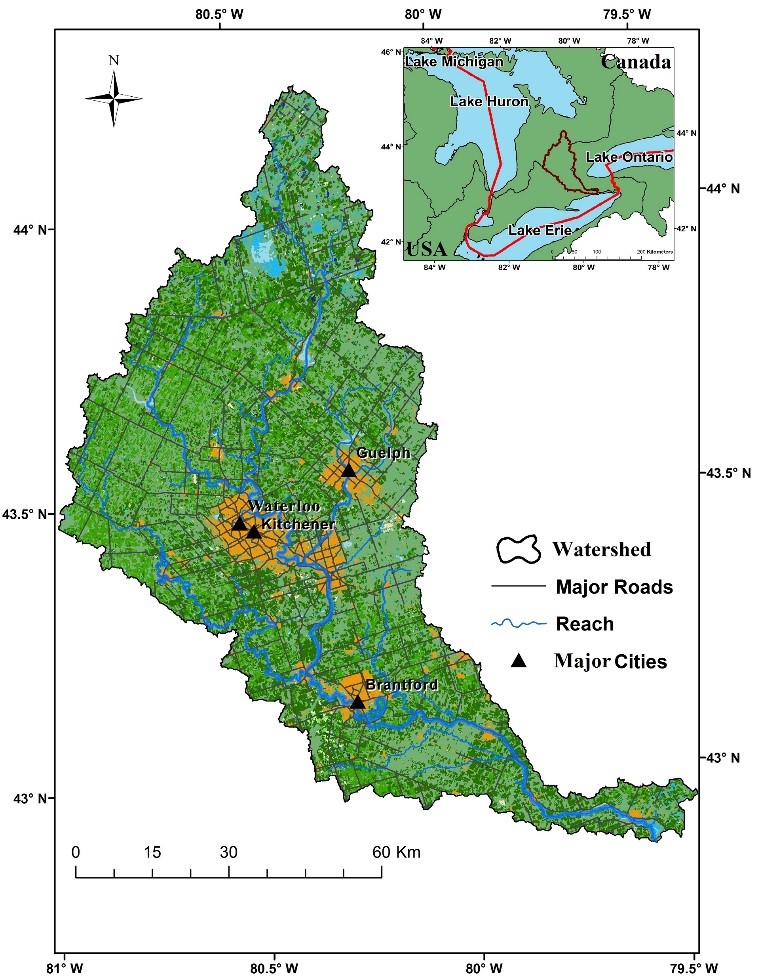
At University of Guelph, researchers developed a hydrological modelling framework using long-term climate data (1950 to 2015) and the Soil and Water Assessment Tool (SWAT) to evaluate the spatial and temporal variability of blue and green water resources and water scarcity. The framework was applied to the Grand River watershed in Ontario, which is a major watershed in the Great Lakes basin. The study was presented earlier this year at the International Association for Great Lakes Research conference.
Observations from the study include:
● Variability in blue water resources occurs as a result of climate factors, primary through precipitation. Green water flow, on the other hand, is associated with temperature, precipitation and land-use/land-cover. The higher the temperature and more intense the agricultural activity, the higher the green water flow. Green water storage is associated with various soil properties and influenced by the depth of soil.
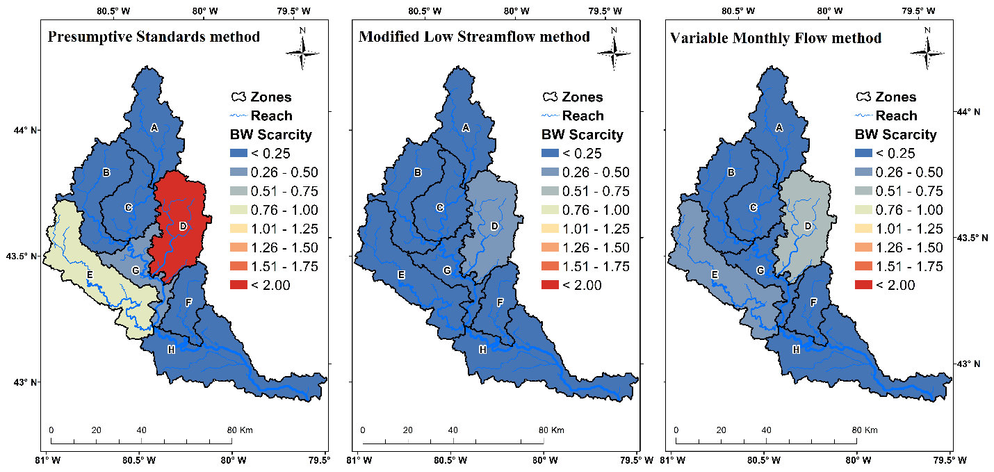
● Blue water scarcity in some regions of the Grand River watershed can be severe, especially in the Eramosa-Speed river sub-watershed (Zone D, below) during summer months, mainly due to the higher percentage of urban area, more consumptive use and less blue water availability. So urban areas can be considered hot spots of blue water scarcity.
● Green water scarcity is not severe in the Grand River watershed. The watershed has enough water stored in soil layers to support agriculture without any source of irrigation.
Such a modelling approach also can be used in other watersheds in the Great Lakes basin. Many basins are encountering changes in their hydrological cycle, losing their natural hydrological stability, which is how a water crisis can develop. Thus, the Great Lakes basin also can become a victim of water scarcity if we don’t manage and respect our precious freshwater resources.

Baljeet Kaur is a master’s student in water resources engineering at the University of Guelph, in Ontario, Canada.