The Current May 2020
In 2016, as a result of catastrophic flooding along Lake Champlain and the Richelieu River in spring 2011, the governments of Canada and the United States instructed the International Joint Commission (IJC) to “fully explore the causes, impacts, risks and solutions to flooding in the Lake Champlain-Richelieu River basin.” The IJC established a Study Board to oversee the Study and to provide recommendations. The IJC also established a Public Advisory Group to assist the Study Board with engaging the public over the course of the Study. The Public Advisory Group publishes this bimonthly newsletter to help keep the public informed about the Lake Champlain Richelieu River (LCRR) flooding study.
Letter from the Public Advisory Group Co-Chairs
LCRR Study scientists have been working diligently throughout the COVID-19-related stay at home period to continue to develop models, analyze data, complete reports, and formulate performance indicators. These are designed to help assess potential impacts of recommendations being considered to mitigate future flooding on people, the environment, and infrastructure. Some of the work being done is highlighted below, including modeling to improve predictions of lake levels, and development of a performance indicator to assess how flooding impacts to homes might be mitigated by various management practices or policies that might be implemented in the future.
Study members in both Canada and the United States are engaging local political entities in meetings to help them understand the current status of the Study, and to get their input to inform Study Board decisions. Meetings with political entities began in May and are expected to continue through June.
The Study’s Communications Team is developing a plan to host virtual public meetings later this year. Watch for an announcement about this soon. We look forward to sharing highlights of Study progress since our last public meetings in fall 2018.
We wish you and your loved ones continued health and wellness as our communities begin to reopen.
Madeleine Papineau, Canadian Co-Chair Kristine Stepenuck, US Co-Chair
Study News
Dynamic Modeling to Allow for “Nearcast” Predictions of Lake Levels
An experimental short-term forecasting model is under development by the University of Michigan Cooperative Institute for Great Lakes Research (CIGLR) and U.S. National Oceanic and Atmospheric Administration Great Lakes Environmental Research Laboratory (GLERL) that will predict Lake Champlain water levels and waves based on anticipated precipitation and wind, as well as inflows to the lake from tributaries in the watershed.
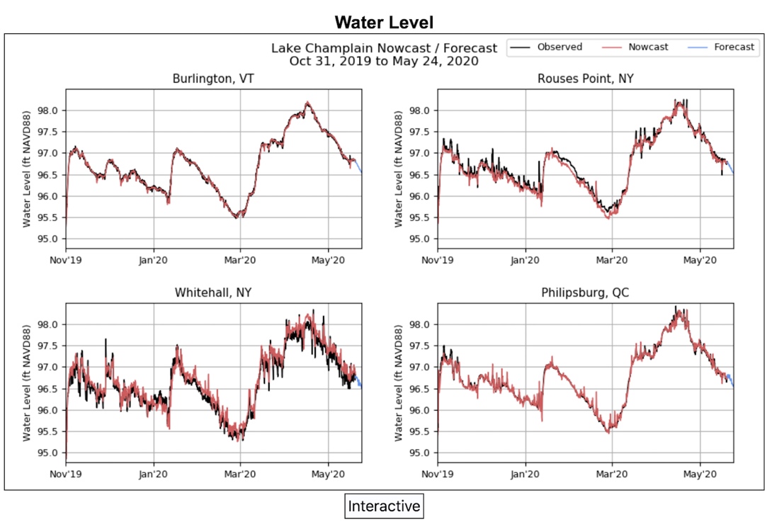
The new short-term forecasting model is expected to be online for Lake Champlain at the end of the year and will provide detailed information about lake levels.
The 5-day “nearcast” uses predictions of NOAA’s operational atmospheric and hydrologic models for wind, rain and runoff, and will provide detailed water level projections at Burlington, VT, Rouses Point and Whitehall, NY, and Philipsburg, QC. The system will likely be used by weather forecasters, emergency management officials and other agencies, but will be available online for the general public to view. The experimental forecasting system is expected to be implemented in real-time operations at the end of this year.
Expert Advisor Highlight
Continuing our series highlighting subject matter experts who are working closely with the Study Board, we spoke with Dr. Curt Gervich, the U.S. co-lead for the Social, Political, Economic (SPE) Analysis Group.
The SPE is charged with determining the social, political and economic impacts of various flood management and mitigation scenarios as part of the Lake Champlain – Richelieu River Study, as well as the likely social, political and economic acceptance of such scenarios among different stakeholder groups.

Curt Gervich, U.S. co-lead, Social, Political, Economic (SPE) Analysis Group
A member of the Study Board’s technical advisors, Curt has worked with the Study Board since April 2017. He is a State University of New York (SUNY) College at Plattsburgh Associate Professor of Environmental Planning, teaching courses in Environmental Law and Policy, Environmental Management, and Sustainability. Each summer, Curt leads a six-week study abroad program in China as co-director of Middlebury College’s School of the Environment.
After earning an undergraduate degree, he attended UVM’s Natural Resource Planning Program, received a PhD from Virginia Tech, and was a watershed planner before joining academia. Curt also serves on the Lake Champlain Basin Program’s Technical Advisory Committee, and was honored in 2016 as SUNY Plattsburgh’s first-ever recipient of its award for “community-engaged faculty member of the year.”
Performance Indicator: Structural Damages to Houses
One of the goals of the LCRR Study is to assess the impacts and benefits of different flood mitigation measures being considered for recommendation on houses built along the shores of the Richelieu River and Lake Champlain. For each measure, changes in predicted damages to each home due to flooding are assessed as a percentage of each house’s value, based on anticipated flood depths that are extrapolated from flooding models.
To make these predictions, researchers use a range of data including the type of house structure, number of floors, height of the lowest windows or doors, past flood damage and water levels, and more. The information is then used to compare different mitigation measures and identify the measures that would likely be most beneficial to reduce flood impacts. Similar indicators are also used to assess total economic losses to all structures based on different flood levels and proposed mitigation measures.
People
To inform the LCRR Study, the Science and Decisions Center of the U.S. Geological Survey (Center) is collaborating with Lake Champlain - Richelieu River Study scientists in Canada and the United States to provide economic analysis that will inform a cost-benefit assessment of flood mitigation measures for the Lake Champlain area. Economists from the Center will work closely with the Study Board and its Technical Working Groups to review and quantify damage assessment criteria for residential, industrial, commercial, agricultural, infrastructure and recreational impacts.
These criteria will be used in a model created for the study known as an ISEE model (Integrated Social-Economical Environmental), which is designed to assess impacts of possible mitigation measures on performance indicators (PIs) — such as the structural damage to houses mentioned above — that the study team has developed. In short, the Center will provide economic data to help inform the Study Board as it works to make decisions about what possible mitigation measures to recommend in its final report to the International Joint Commission.
On the Web
If you would like to read the Causes and Impacts report or the booklet, they are available on the Study Board’s website (https://www.ijc.org/en/lcrr) in the “Publications” section under the “Library” tab on the home page.
Stay updated on the Study Board’s work and publications by signing up to receive electronic updates via our email distribution. Click on our home page (https://www.ijc.org/en/lcrr) and scroll to the bottom to join.
Public Meetings
Due to the COVID-19 pandemic, previously-scheduled public meetings scheduled for early May were postponed. These will now take place virtually in the fall. A planning team is working to prepare an agenda that allows for updates to be shared by study scientists about ongoing efforts to understand and make recommendations that, if implemented, can help minimize future flooding impacts while at the same time, enabling members of the public to ask questions, and to provide feedback about information that is presented.