A computer model detailing the origins and extent of nutrient pollution in the Great Lakes watershed has been created by the IJC and Canadian and US government agencies.
The IJC, US Geological Survey (USGS) and National Resource Council Canada (NRCC) worked together to develop watershed models, which describe how nutrients like phosphorus and nitrogen enter water systems throughout the midcontinental region of North America. This includes the Great Lakes and streams and rivers that connect to each of them.
The project was done using the SPARROW model, which stands for SPAtially Referenced Regression on Watershed attributes. The USGS originally developed SPARROW models for specific regions of the United States, but recently joined with the IJC and NRCC to apply the model in the binational waters along the Canadian-US border.
Why are the results from this model useful?
Under the Great Lakes Water Quality Agreement signed by Canada and the United States, both countries are obligated to do their best to protect and restore the Great Lakes. One part of the agreement targets nutrients and focuses largely on phosphorus reduction.
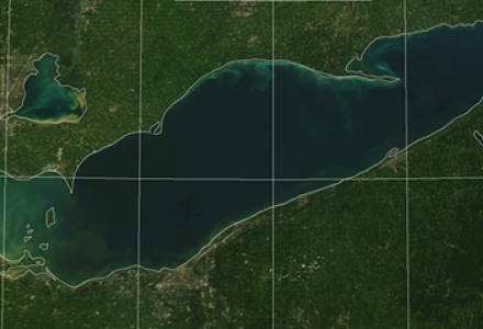
Despite this focus, some lakes – especially Lake Erie – continue to have serious issues with excessive nutrients entering the nearshore. These nutrients contribute to unusually large algal blooms and oxygen-poor dead zones in deeper waters. These issues have plagued the lakes since the 1990s.
Nutrients can originate from wastewater treatment plants in cities, urban runoff, excessive fertilizer and animal waste used in agriculture, and forested areas. Using SPARROW models, water managers and governments can better pinpoint areas with the largest inputs and the primary sources of these nutrients. Resource managers can then use this information to refine their plans to help reduce the amount of nutrients that get into the Great Lakes.
What’s more, the results of these computer models can be accessed online, and users can zoom in to see amounts of nutrients delivered to streams and lakes in specific areas. The results of the model have been published in the Journal of the American Water Resources Association.
SPARROW models also show how nutrients are delivered into water systems throughout the Rainy-Lake of the Woods basin, which straddles Minnesota, Ontario and Manitoba, as well as for the Red River basin, which runs through Minnesota, North Dakota and Manitoba before emptying into Lake Winnipeg.
Combined, the models and resulting maps cover an area that straddles portions of 15 US states and three Canadian provinces. The IJC is very concerned about nutrient pollution. Under the Boundary Waters Treaty, neither country can pollute shared waters to the detriment of the other.
The models were developed using what are called 2002 water quality datasets. These were built out of water quality measurements made by the states, provinces and federal governments over several years, including 2002. These measurements are combined with geographical information from both countries that describe the sources of nutrients and the factors affecting their delivery over the entire binational area the models cover.
The modeling work started in the Red-Assiniboine River basin in 2011, and these mid-continental SPARROW models (including the Great Lakes one ) were completed in 2019. Since their development, water quality and geographical information has been updated. The IJC, USGS and NRCC are now looking to further improve the models with this newer information and datasets.